Asset Management is the practice of managing assets to achieve the greatest return (particularly useful for productive assets such as plant and equipment), and the process of monitoring and maintaining facilities systems, with the objective of providing the best possible service to users.
PDM has in-house GIS specialists that utilise a range of asset collection tools from laser scanning to high definition imagery capture to assist in the information gathering and measurement of assets.
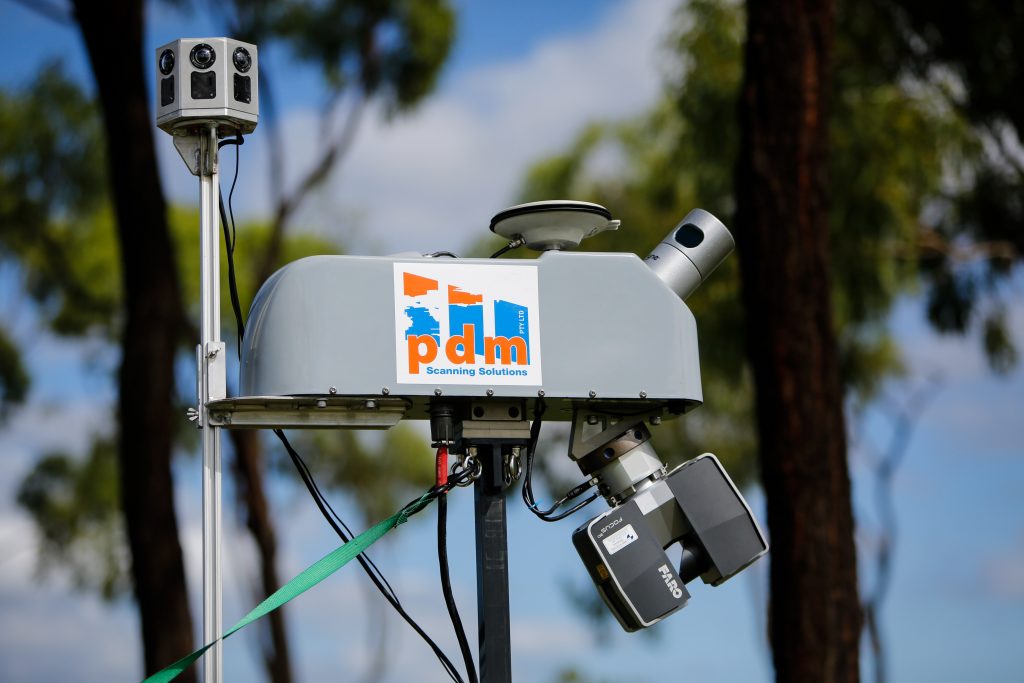
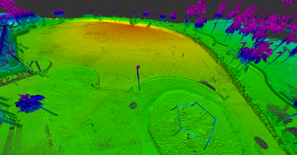
PDM’s Laser Asset Measurement System (LAMS) utilises one of the most versatile LiDAR systems on the market today and current high definition imagery capture devices for the delivery of high density point clouds and colour geo-referenced imagery.
GIS (including Technical Support)
Application Development - Desktop, Web & Mobile
Enterprise GIS Implementation
3D Visualisations & Simulations
GIS Data Creation & Analysis
Remote Sensing & Topographic Data Collection
Technical Support
Asset Planning
Asset Imagery (PDM LAMS)
Laser Scanning (PDM LAMS)
Needs Assessment & Business Process Reengineering
Desktop, Web & Mobile Mapping
Building Information Modelling
Database Design & Maintenance
Imagery Capture
Laser Scanning
PDM’s LAMS System’s versatility is in its capability of easily being fitted to either a standard road vehicle, all-terrain-vehicle (ATV), train, boat or aerial platform which truly stands out from other mobile units. PDM additionally have the flexibility to either front or rear mount the scanner on both a standard vehicle or ATV. This provides for fast and safe collection of LiDAR data in all environments.
At PDM, we utilise a forward mounted scanning system to capture gravel roads, ensuring the best quality imagery is obtained. Further versatility is provided with PDM’s scanning system having the capability to provide static scanning by utilizing a Faro Focus 3D scanner for high density of static environments. This delivers to our clients unparalleled flexibility of both mobile and static scanning solutions.
In addition to a versatile scanning system, PDM’s scanning team has a strong background in engineering and modelling. This gives PDM the edge in delivering a product suitable for it’s intended task, as there is first hand knowledge in how the data can be utilized in new and existing workflows
Laser and Imagery Capture
PDM utilizes a range of equipment and methods of scanning to best suit the objectives of our clients and the environment being captured digitally. PDM’s LAMS platform is extremely versatile, able to be mounted on a range of vehicles in various configurations to suit the environment being scanned. This includes:
As Constructed/Built Modelling • Reverse Engineering • Modelling for Movies/Games/Simulations
Volumetric Analysis • Flood Modelling • City Planning
The field is rapidly evolving, with new applications being realized as the full potential of reality capture is unlocked across a variety of fields.
PDM LAMS Asset Capture
Asset Capture
PDM’s survey grade high definition mobile video equipment is ideal for councils to measure and view their roads with precision and clarity. The demonstrated benefits regarding this technology is the rapid capture and assessment for DRFA claims and asset condition assessments that is accurate and repeatable.
In Queensland, Queensland Reconstruction Authority (QRA) has been borne to manage the State Government interest in controlling finance’s to councils for disaster relief. This has seen techniques for assessment and technologies that vary significantly. PDM is leading the way in North Queensland with its mobile mapping system by providing council’s with accurate data that QRA insist be provided as evidence for any damage claim on council assets.
Past Works - PDM LAMS System
We have previously undertaken Asset imagery for the following clients:
Burdekin Shire Council flood repairs NDRRA 2010 – 2014
Charters Towers Regional Council NDRRA 2010 – 2014